Legend
Base Layer
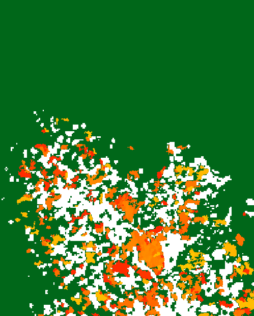
- Title
- Forest loss maps for 2018 and 2019 in Vietnam, Cambodia and Laos
- Description
- Forest loss maps every week for 2018 and 2019 in Vietnam, Cambodia and Laos using Sentinel-1 data at 10m pixel size. This work has been founded by ESA in the frame of the SOFT project (4000129739/20/I-DT).
- Organization
- GlobEO / CESBIO / CNES / ESA
- Projection
- EPSG:4326
- Extent
- 95, 5, 115, 25
Measures
Permalink
Scale